在西引26據點,我觀看日落。站在26據點那邊,剛好有三山據點那條海角在西邊,所以日落更漂亮。(我覺得站在陸地的最西端看日落其實沒有那麼好。因為日落周邊只有海洋,所以沒有跟太陽會對照的東西。)
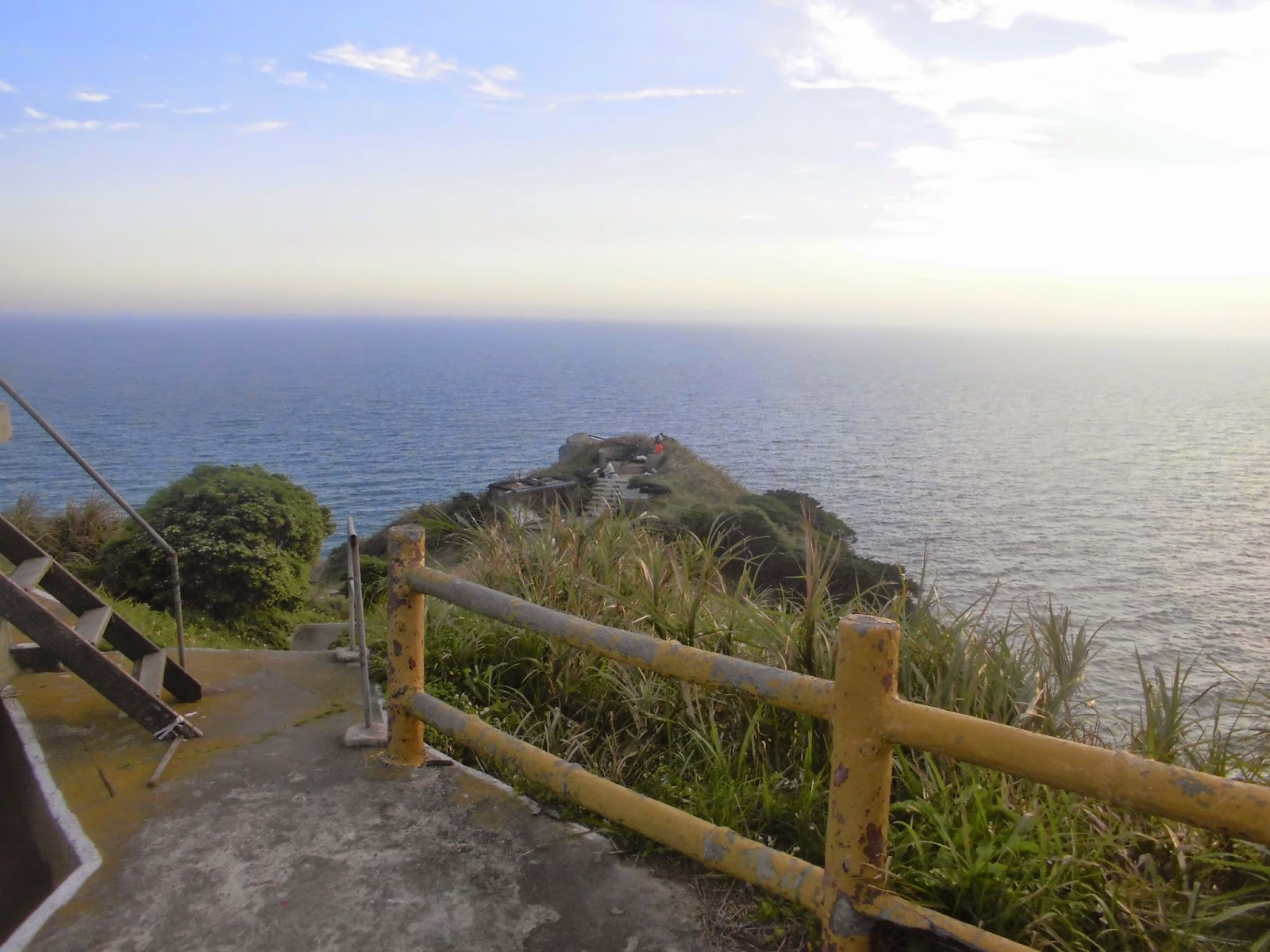
Here's the last bunch of photos from Dongyin/Xiyin. After leaving the 33 fort on the westernmost peninsula in Xiyin, I went to the other peninsula that sticks out to the south. The map below is all in Chinese, but you should be able to tell where Zhongzhu island is (the small island in the middle of the two big islands which has dikes on either side of it connecting it to the two big islands) and the peninsula I'm taking about is the one just to the left of that island. From there, I watched the sunset behind the other peninsula that I had just been on.
西引で最後に訪れたのは「両六」という軍基地。そこで日没を見た。西方に三三の基地がある半島が伸びているので、陸地の隣りに太陽が綺麗に沈んでいくのだ。

對方是三山據點的地方。
The piece of land we see here is the peninsula where fort 33 (Sansan) is.
向こうはその三三(三山とも書く)基地がある半島。


Here we're looking east towards Zhongzhu and Dongyin.
東向いたら中柱島と東引が見える。


The abandoned bunkers were open, so I headed in to check them out.
廃墟となった施設に入ることができる。


A graph of the area that can be seen from the window.
窓から見える周辺の図


「いらっしゃいませ」と書いている。ここ軍施設じゃなかったっけ?そんなの書いていいのか?


Oil, rice, water, etc. Maybe they still use this structure for training or something. I'm not sure.
まだ訓練とかでここ使っているかもしれない。


looking east at Dongyin


Going back to the hotel
東引に帰っているところ


Here I am at the port in Dongyin.
東引の港に戻ってきた。

After spending only one day in Dongyin, it was already time to leave. I left early the next morning for the main island in Matsu, Nangan. From there I got on another boat to Dongju, one of two small islands to the south. Upon arriving at Dongju I found that it too was covered in fog.
翌日船に乗って馬祖の中心になる南竿島に渡って行って、そして別の船で東莒という小さな島に行った。着いたら霧が濃くて、不思議な世界に到着した気がした。

Next up, Dongju!
じゃ、今度は東莒のことを紹介しよう!
No comments:
Post a Comment