For this trip to Okinawa, I stayed in the northern part of the island. The map below (click it to see a bigger version) doesn't have the borders of the various towns drawn in, but it does have their names, so you can get a general idea of where they are. The big peninsula on the north-eastern part of the island is often called "Yambaru", and it's split up into three towns: Ogimi in the south-west, Higashi in the south-east, and Kunigami covering the northern part of the peninsula. If you go to Okinawa and you have a car, going around this peninsula is one of the best things you can do. The area is mountainous and very rural. It's beautiful and shows you a totally different side of Okinawa from what you see in the urban southern part of the island.
今回、沖縄北部の国頭村に宿泊した。沖縄北東部はヤンバル(山原)と呼ばれている。下の地図には市町村の境目が書かれていないが、一応名前がローマ字で載っている。半島の上半分は国頭村、下の西部は大宜味村、下の東部は東村だ。沖縄に行ってレンタカーを借りたら、是非このヤンバル地方を回ってみて下さい。山が多くて人口が少ないので、沖縄南部・中部では見られない様な風景がある。私の考え方では、ヤンバルは「車で行ける離島」だという感じである。
這次旅行,我住在沖繩的北部。北東部的半島叫做「山原」,有三個城鎮。最北的叫「國頭村」(Kunigami),在西南部的叫「大宜味村」(Ogimi),然後東南的叫「東村」(Higashi)。(把下面的地圖點一下,就變大了一點,看得到我說的城鎮。)沖繩南部有很多人,還有地形比較平。山原地區有很多山,人不多,所以跟南部比起來完全不一樣的樣子。
I stayed in Kunigami, on the west side of the peninsula, so I started by driving up the west coast. The main road, 58, goes all the way down to Naha, the main city in the south of the island. This road was built by the US military originally to connect the various bases on the island. Up in this part of the island, the road travels right next to the coast, so you have the blue sea to the west, the mountains to the right, and not much else. There are also period places to stop so that you can get out of your car and experience unbridled, scenery-induced bliss while not in your car. (Experiencing such bliss while in your car will often lead to accidents.)
国頭村の辺土名(西海岸)に泊まっていたので、まずは58号を北上した。58号は米軍が作った道で、那覇まで繋がっている。元々米軍基地を繫げる為に作られた道路だった。ヤンバルにある58号は海岸沿いの非常に綺麗な道だ。
我住在國頭村的西部,所以我先用58號的馬路往北去了。其實,58號從那霸開始,是沖繩最重要的馬路。原本是為了溝通基地美軍做的。在山原,58號在海岸,看西邊就看到海,看東邊就看到山。非常漂亮!
As in most of Okinawa, the sea around the island is filled with coral reefs, and therefore very shallow close to the island.
珊瑚礁による沖縄近海はとても浅い。
沖繩周邊都是珊瑚礁所以海很淺。
A diagram and explanation of how they built this coastal road to replace the old one, which used to pass more inland.
現在の58号線が出来る前には、陸奥の道路があった様だ。
做現在海岸的馬路之前,有另外山裡的。
Yambaru is very mountainous, so there are a number of dams and lakes. Okinawa gets a lot of rain, but it's a small island, and the southern part is mostly flat and made of formal coral reef, so it's very pourous and doesn't hold a lot of water. The water that they store up here in Yambaru helps supply the entire island. Here's one of the dams (I think it's Henoki):
ヤンバルには山が多くて、ダムと湖が沢山ある。雨が多いのに、以前沖縄は頻繁に干ばつに見舞われた。島の南部は元珊瑚礁で、低くて、水が流れやすい土になっているので、水がなかなか溜まらない。ヤンバルに貯水した水は全島の生活を支えている。こっちのダムはたしか、辺野喜のダムだと思う:
沖繩下非常多雨,可是南部都是珊瑚,也很低,也儲水不好,所以以前平常有旱災。現在因為在山原建很多堤霸,所以可以把山原的水發給沖繩到處。
More bliss! Oh god, the bliss!
Some sort of bird.
The Japanese government/construction industry/yakuza love laying concrete everywhere they can. When they run out of roads to build, they plop down some concrete along the coast, or up a mountainside.
日本では至る所にコンクリートで覆われている気がする。こんなに必要あるのか?
I'm almost at Cape Hedo, the northernmost point of the island...
This gaudy structure is a giant statue of a Yambaru Kuina (Okinawan Rail), a bird endemic to the Yambaru region. It's a lookout point, but it was closed for construction when I went by.
辺戸岬の近くに、このダサいヤンバルクイナの像があった。展望台だけど、私が通った時は工事中だった。ヤンバルクイナはヤンバルにしかいない鳥だ。
下面的瞭望台有山原ㄎㄨㄧㄋㄚ(山原水雞)的樣子。這種鳥只生息山原而已。
And here we are at Cape Hedo!
辺戸岬に着いた!
到了邊戶岬!沖繩最北的地方。
There were a lot of butterflies.
蝴蝶很多!
Another gaudy bird statue. I'm not sure what this is supposed to be.
また変な鳥が、、、
After leaving Cape Hedo, I passed by the local elementary school. They had a sign up out front saying that they were looking for students. Like most rural areas in Japan, this area is suffering from a shrinking and aging population. The school is making an appeal to people who have jobs that can be done remotely to consider moving here and enrolling their kids in the school. The school currently only has 6 kids, and the community I'm sure doesn't want the school to have to close.
辺戸岬周辺にある小学校の前にこの看板がある。日本の少子化問題は特に地方では深刻だ。
離邊戶岬很近的國小在找學生。跟臺灣一樣,日本孩子越來越少了,尤其是鄉下的情況很難。這個看板請可以用電腦在家裡工作的人考慮一下搬到這裡,讓孩子上這裡的學校。自然多,環境很好。現在只有六個學生而已,所以學校找不到學生,有可能就被關門了。
I'm still up in the Hedo/Oku area at this point. There's a grave here for a former king, Gihon.
辺戸岬の近くの村落、「奥」に義本王のお墓がある。
在這邊有一個國王的墓穴。
Gihon was an unfortunate king. He was the third and last in a short line of kings (the Shunten line). It's said that because his reign was filled with natural disasters, this was taken as a sign that he should resign, and he appointed a capable lord, Eiso, to be the next king. (You can see the influence of the Chinese idea of the mandate from heaven here in the way the situation is described.) He then retired to the northern part of the island, where he was eventually buried.
However, this was all back in the 1200's, so the details are not all clear. It may be that Eiso violently overthrew Gihon and killed him or had him exiled and that the story of Gihon abdicating his throne was later created by supporters of Eiso to legitimize his rule. It's also unclear how much territory this King Gihon controlled to. Later Ryukyu dynasties typically claimed that the Shunten lineage controlled the whole island of Okinawa, but this may have also been fabricated in order to legitimize their own rule over the whole island. It's possible Gihon may have only controlled one territory on the island of Okinawa. We don't really know. (Click the photo to enlarge and read it. Well worth the effort of a click.)
下の写真をクリックして読んでね。めっちゃ面白い。義本王は13世紀に生きていた国王で、舜天王統の三人目、そして最後の王だった。即位後、天災が頻発し、そこで義本は優秀な「英祖」という貴族に国営を任せて、最終的に位を英祖に譲った。その後ヤンバルに移って、そこで亡くなった。
しかし、これは全て13世紀の話だから、詳しいところははっきり分かっていない。もしかして、義本は英祖に転覆されて殺された、またはヤンバルに島流しになったかもしれない。英祖の即位に賛成して、その正当性を訴えた人は、後で義本が英祖に地位を譲ったという嘘の話を作った可能性もある。
また、琉球王国の公式の歴史によると、舜天王統は既に全沖縄を支配していたと記されているが、義本は実際に全島の国王か、あるいは一つの地方の有力者にすぎなかったか、はっきりしていない。琉球王国はもちろん、自分の支配を正当化させるために、以前の支配者は全沖縄を支配したと言ったが、その証拠は今のところないらしい。
這個國王,「義本」,是「舜天朝」第三個國王,也是最後一個。嗣國以後,國家發生了很多天災。後來他叫一個貴族,叫名英祖,替自己領導國家。因為都變好了,所以義本下台了,叫英祖當國王了。從英祖開始「英祖朝」。義本搬到山原,在那裡過世了。(這個故事,聽起來像中國的歷史一樣。)
可是,我們其實不知道這個故事是否真的。在現在的研究上,13世紀沖繩的歷史還不太清楚。也有可能英祖把義本推翻了,殺他,還是讓他流亡。後來贊助義本的人做出來這個故事,讓英祖看起來是天選的人。我們也不知道義本統治怎麼大的國家。後來,琉球王國主張舜天朝時候,沖繩已經是統一的。但是現在還不能證明。有可能義本只統治沖繩的一個地方而已。
The grave is very cool though. It's designed like a traditional Okinawan house. There is a surrounding wall, and just inside the entrance is a second small wall so that you can't walk straight in.
このお墓は沖縄の民家と同じ造りだ。周りに屏があって、玄関のちょっと入ったところにもう一つの屏があるので、直進できない。
墓穴看起來像琉球的傳統民家一樣。外面有一個牆,在正門裡面還有另外一個小小的牆。
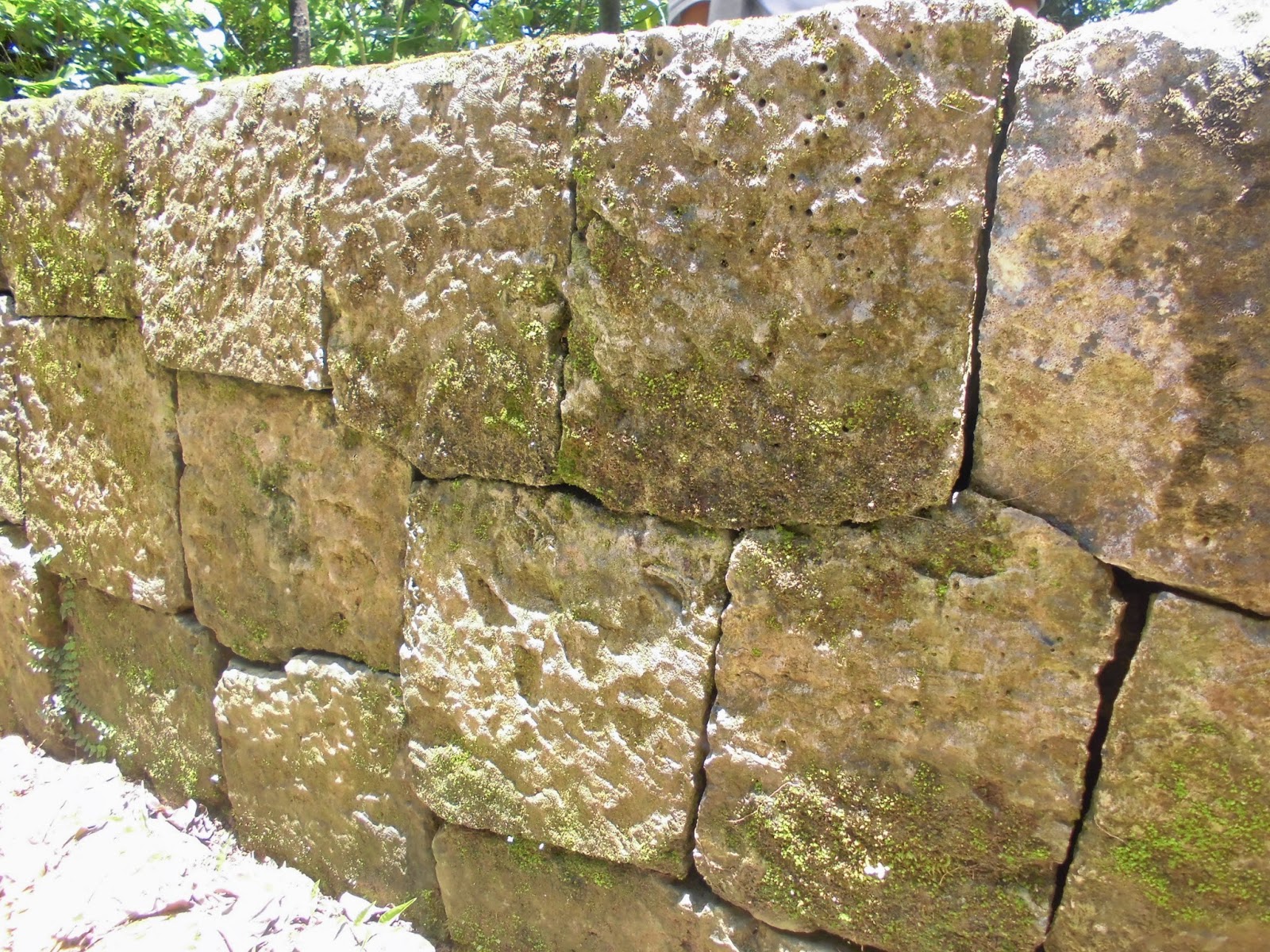
The stonework is the usual Okinawan style. The stones may be in all sorts of random shapes, but they fit right together.
It's obvious that people still come here to pay their respects. You can see the small offerings in front of the grave.
このお墓に今も人がお祈りしに来るみたいだ。
還有人來拜拜。
I don't know what these huge leaves are for sure, but they look like Taro potatoes. They're everywhere in Okinawa.
この葉っぱを沖縄の森とかでしょっちゅう見掛けるが、里芋によく似ている。本当に里芋はこんなに自然に繁殖しているのか?
芋頭嗎?沖繩到處看到了這種葉子。
Colorful bug carcas
虫の甲羅
And some weird plant-thing
何かの植物の変わった種
植物的種子。
More next time!
また次回!
下次呢!


