昨日のポストの続きで〜す。
沖縄の二日目は本島南部のグスクを見に行った。グスクはよく「城」と言う漢字が当てられているけど、本来の意味は「神聖な場所」だ。沖縄の場合はその二つがよく一緒に成っていたから「城」と書く事が多い。沖縄の多くのお城の中には一カ所、二カ所聖なる場所が有る。でもお城より神聖な場所の方が古いと言うのは普通だと思われている。
昔から沖縄本島の南部は一番人口密度が高い。島の南部は珊瑚礁で出来ているから、高い山があまり多くなくて、北部より農業に適している。(因みに、北部は元々大陸と繋がった土地から出来ているので、山が割と多い。沖縄本島の一つの島に琉球列島の典型的な島のタイプが両方とも揃っている。他の島は大体「元大陸」か「珊瑚礁」か、どっちかから成っている。)
人口密度が高いから、勿論昔から村落が多かったわけだ。村落毎にグスクが最小でも一カ所有ったのは普通だった。元々聖なる場所には特に建物は何も無かった。今もそう言う場所が沖縄に沢山有る。仏教が日本に伝わって来る前に、日本の神道も一緒だったと言う説が有る。大きな木とかが有って、そこで自然に人が集まってお祈りしたりすると言う宗教だったかも。その大きな木の隣りに神様を祀る建物、神社、を建てて置くのはもしかして仏教を真似して発想したアイデア。沖縄は日本より仏教が遅れて入って来たし、上層の人達以外にあまり広まっていないので、沖縄の宗教は日本の神道より本来の形が残っていると論ずる事が出来る。
とにかく、沖縄の社会にいつか農業が入って来て、社会がだんだん複雑に成って来たから、各村落に聖なる場所だけじゃなくて、今回はその地域を指導する、または支配する人が現れて来た。「按司」(あじ)と言う。各村落に砦みたいな建物を作ったから、今沖縄南部を車で回ったら、沢山の城跡が見える。一日でも時間が足りない程沢山有る。多くのは石垣しか残っていないけど、だいたい景色の凄い所(山の天辺とか)に有るから、見に行く価値が有るよ!
Continuing from yesterday, on the second day in Okinawa, we decided to rent a car and drive around the island's southern part. The southern part of Okinawa is the most densely populated. This has been true for all of Okinawa's history. The southern part of the island is made of former coral reefs, so it's relatively flat and therefore easier to farm than the hilly northern part of the island which is made of land that was originally connected to the Asian mainland during the last ice age. These two land types: hilly former continent and flat former coral, are both seen in the main island of Okinawa, but most islands are either one or the other.
Because the southern part of the island is so densely populated, there have always been a lot of villages here. Each village usually had at least one sacred spot, often called a "Gusuku". As society became more complex and a leadership class emerged, they sometimes constructed walled buildings in high, easily defendable spots, often where the Gusuku was. As a result, many Gusuku are contained within fortress walls. However, there is debate over whether it is more appropriate to translate "Gusuku" as "sacred spot" or "fortress". (I prefer the former myself.)
The south is so dense with these former fortresses that you can rent a car and drive around for a day and not see them all. Even two, three days might not be enough. Most of them are overgrown and all but invisible to the untrained eye, and you would be unlikely to find them if there weren't signs pointing them out, but some of them are being reconstructed, or at least the area around them is being fixed up a bit.

We met this pretty kitty in the morning near the hostel we were staying at.

Naha has a monorail line.

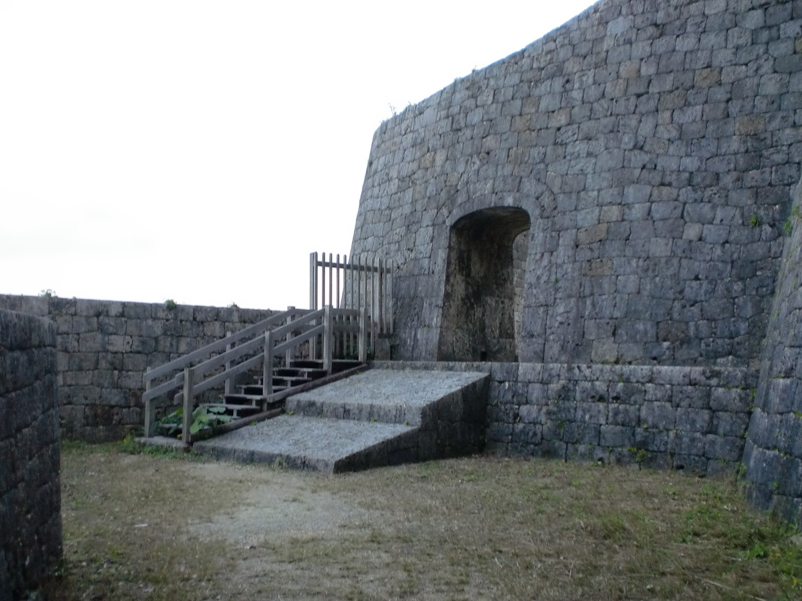
The first place we visited was Gushikawa Fort. This is one of my favorites because it's right next to the sea on a cliff, which is a little unusual since most of the forts seem to be up on hilltops. It's been fixed up a bit since last time I was here.

This path was not here last time I'm pretty sure.


I didn't take a very good picture of it, but can you see the fence on the right side of the above photo? There's a hole in there that goes down to the sea. This fort is on a sea cliff, so it's difficult to attack from all but one side, and thanks to this hole, forces inside the fort could secretly get in and out even when under siege.


サファーが沢山居った。12月でもウェットスーツさえ着れば海に入れる。寒いけど。
It's a little cold, but if you wear a wetsuit you can go in the ocean in December in Okinawa. These people were surfing.


On our way back to the car we saw this pretty bird. Actually we saw a bunch of them while in Okinawa. It's called a Blue Rock Thrush.


Nearby Gushikawa Fort is Cape Chan. (Or Kyan) It's a very beautiful area, but like the beautiful cliff top from yesterday's post, there's a memorial to those who died in the war.

When we got back in the car I noticed some Gusuku who's name I was not familiar with on the GPS map. We decided to go and check it out. When we got to the area, it turned out that there was a hiking trail that you had to walk on to get to the Gusuku. We walked for about 10 minutes, but it was never 100% clear where the Gusuku was. This is not uncommon with some of the smaller, older ones. Because they were sites of nature worship, oftentimes they're located next to a natural cliff face. Even if people added walls afterwards, the natural cliff formation was the main focus. Added to that is the fact that some of these places have been relatively untouched for decades (centuries?) and that means that some of them have largely returned to nature. Or maybe there was never much of a building to begin with. It's unclear. Probably the only reason anyone knows where this site is is because people from the area probably still come here to pray. I think the two photos below are probably the Gusuku area.


Next we went to Chinen Fort. This is another one that's being fixed up a bit.


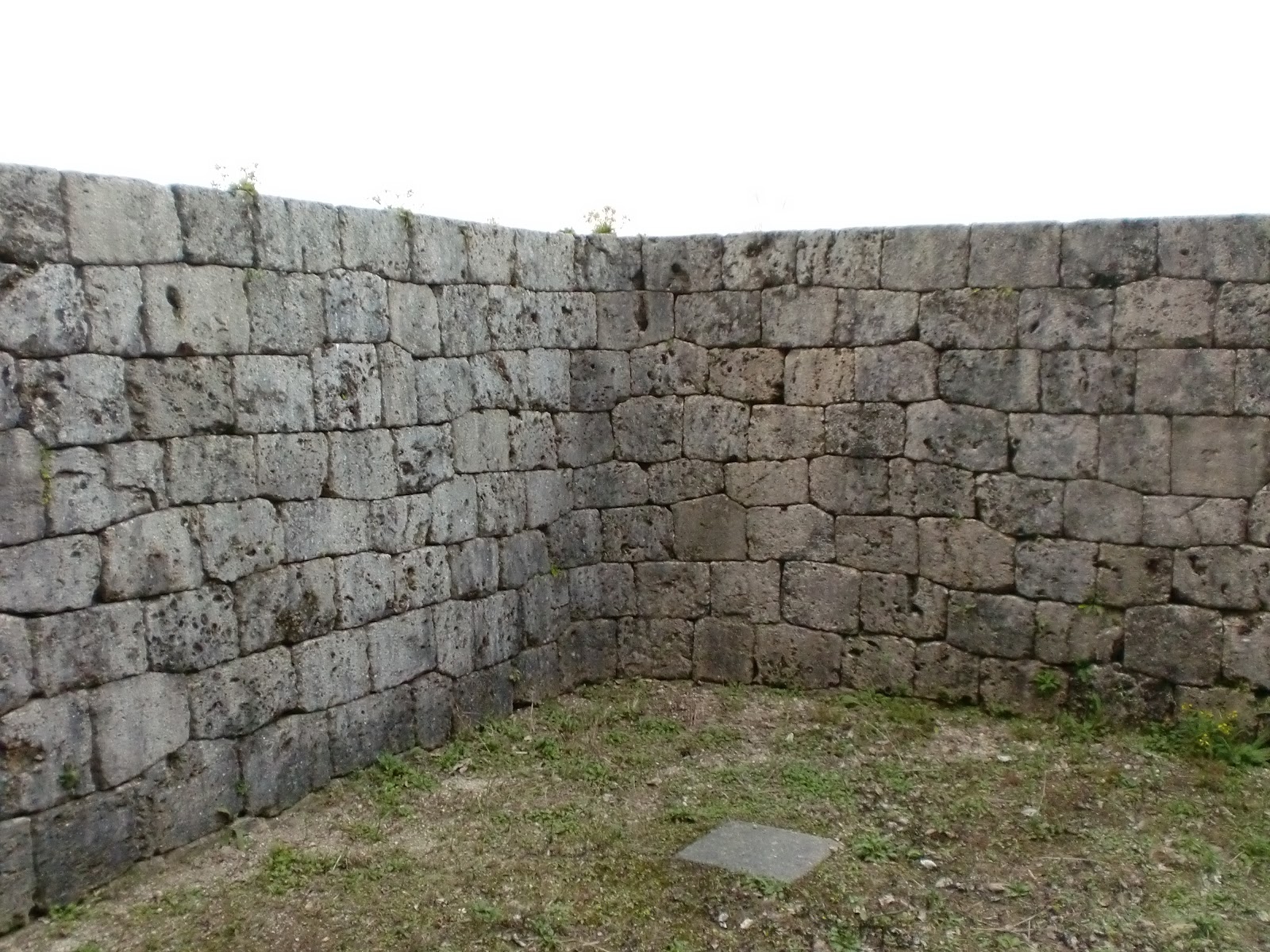
The stones that they used to build these forts are the former coral stones that are common in Okinawa. One of the stones above appears to in fact be a brain coral!


It's a pigeon, though a little more handsome than the NYC variety.

This is the location where rice is said to have first been planted on the main island of Okinawa. The "five grains" were originally given to people by the gods and planted on Kudaka Island nearby. The five grains are probably rice, wheat, millet, soybeans, and something else. I'm not sure exactly.

If you climb a hill from the original rice field place, you come to the gravesite for the Chinen Aji. ("Aji" is a local powerful person in a community. One of the Chinen Aji way back when presumably built the Chinen Fort.) The descendants of the Aji are still living in the area I've heard.


I thought this shiny beetle was pretty.
次に行ったのは、斎場御嶽だった。(セイファウタキ)「御嶽」もグスクと同じく「聖地」って意味が有る。この斎場御嶽には城跡が無い。ここは琉球王国時代の一番大事な聖地だった。国王以外は男性立ち入り禁止だった。しかも、国王もお参りする時は女装をして入ったと言われている!一般人も基本的に入れなかったので、入り口に、中の聖地の数に当たるお香を置く為の石が有る。一般人は入り口でお参りした。
沖縄の宗教は琉球王国時代から国王に組織化させられた。国王に近い女性(妹とかが多かった)は「聞得大君」の位に就いて、下に各地域の神女(ノロ)が置かされた。琉球王国以前の時代にはそういう組織が無かった。斎場御嶽はもっとも重要な聖地だから、深く聞得大君と関わっている。
The next place we went was Seifa Utaki. "Utaki", like Gusuku, also means a sacred place. Seifa Utaki never had a fort built around it. However, it's like the Vatican of the Ryukyu Kingdom. Seifa Utaki was one of the most important religious sites that the Ryukyuan King visited. It was under the control of the "Kikoe Ogimi", who was always a female relative of the king. Before the Ryukyu Kingdom united the island, there were "Noro", (witches? female shamans? I don't know what to call them, but local women who were in charge of the communities spiritual affairs) all over Okinawa. The Kingdom decided to formalize this relationship, probably to help cement their control of the island, and they placed all Noro under the authority of the Kikoe Ogimi at Seifa Utaki, who, like I said, was always a female relative of the king.
Seifa Utaki was such an important sacred site that most people could not enter. There are stones left at the entrance that correspond with the sacred areas inside the grounds. Most people prayed at the stones at the entrance. Like many sacred places in Okinawa, Seifa Utaki was also off-limits to men. Even the king, when he visited, would dress in woman's clothes.

There used to be buildings on the grounds, but not anymore. This is one the spots where people will pray.


Water drips from the stalactites above into the pots below. It's sacred water, so the sign below asks us kindly not to touch it.

Seifa Utaki is still an active religious site. People do come to pray here. Actually, I've heard that many of the Gusuku and Utaki around Okinawa are still actively used. Many of them don't look like much since they're overgrown by plants and don't have any buildings to speak of, but that doesn't mean that they're not used.


After passing through here, you can look to your left and see Kudaka Island, the island of the gods.

Kudaka Island is the low, flat bit of land on the ocean top. It's another one of the most important religious sites in Okinawa.


浦添ようどれは中山国王の英祖のお墓だ。中山と言うのは、統一された琉球王国が出来た前に、北山、中山、南山と言う三つの国が有った。(中国にも、琉球にも三国時代が有ったね!)浦添グスクは中山王の城で、その下に墓地も有った。琉球を統一した人物、尚巴志王、は最初に中山を支配して、自分のお父さんを国王に就かせて、(凄い親孝行)後で南山と北山を支配した。沖縄全域を支配した後でも、琉球は「中山」と言う名前を使い続けた。琉球王国が出来てから、殆どの国王は那覇市内の玉うどぅんに埋葬される事に成ったけど、一人の浦添生まれの尚寧は浦添ようどれの改修に力を入れて、そこに自分を埋葬する事にした。(勿論、死んでからね。)
The last place we visited this day was Urasoe Yodore. This is a grave for Eiso, a king of the Chuzan Kingdom. Before Okinawa was united into one kingdom called Ryukyu, there were three kingdoms called Hokuzan, Chuzan, and Nanzan. (Literally, "North Mountain", "Middle Mountain", and "South Mountain".) Chuzan was centered at Urasoe, where on a hilltop overlooking the port there was a castle, and below that was the Yodore.
Actually, the name "Chuzan" continued to be used even after Okinawa was united. The guy who united Okinawa, Sho Hashi, first took over Chuzan and made his father its king. (He was a such a good son!) Then he took over the other two kingdoms in his father's name, so even after the name "Ryukyu" started being used, the name "Chuzan" continued to be used as well. The capital of Ryukyu was moved from Urasoe to Shuri, and most kings are buried there, but one king, Sho Nei, who was born in Urasoe decided during his reign to fix up Urasore Yodore and to be buried there.


There used to be an arch in the above photo. It got hit by a bomb during WWII. It used to be that you would pass under the arch and emerge into a courtyard where, if you looked to your left, you were facing Kudaka Island, just like that spot in Seifa Utaki. They think that this featured was designed to mimic Seifa Utaki.


There are two doors to the graves. The left one is where Sho Nei is buried. The right one has Eiso. Eiso was the king of the Urasoe area way back when. He may have even controlled all of Chuzan (the middle part of the island) but it's unclear. The official Ryukyu history, written by historians under the patronage of the king, states that Eiso controlled all of Okinawa, but it seems rather unlikely that this was true. It's thought that the Ryukyu Kingdom, in order to legitimize its rule, came up with the fiction that the island had once been united, and that Sho Hashi had reunited it after a period when a series of kings who led decadent lives had caused the kingdom to fall apart into three separate kingdoms. A lot of historians (though not all!) think that it's more likely that local leaders emerged all over the island and over time built up their influence and power until the point where there were three kingdoms, and that when Sho Hashi united the island, that was the first time in the island's history.


These two photos are also the cityscape, but it was getting dark, so they came out strange.

で、因みに、カメラの設定でふざけたから、写真は全てこのセピアに成っている。まあ、雰囲気的に合っているかな。
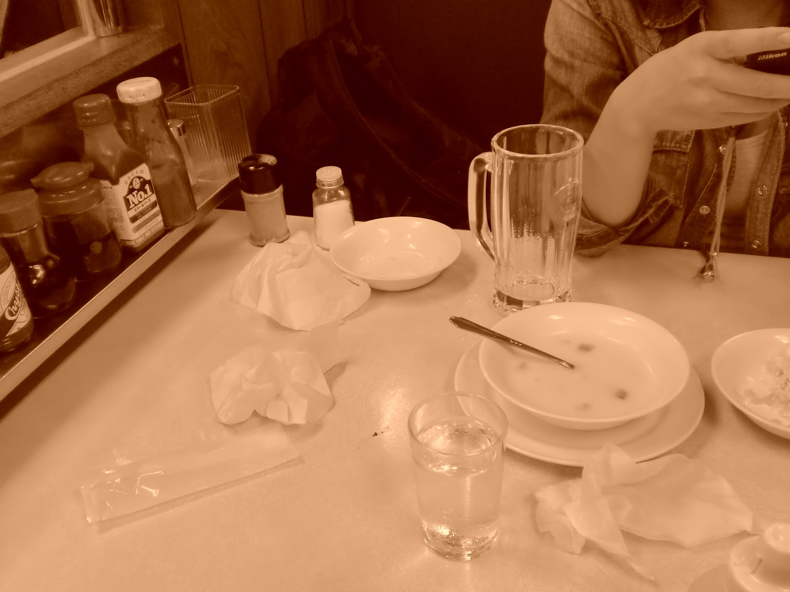
After we returned the rental car, we went to this place called Jackie's. It's an American Diner style place that specializes in steaks. It's been around for decades, so it started business under the American occupation. They had their old "A" mark displayed up front. The "A Sign" was a system instituted by the US military government on Okinawa where they would inspect restaurants and give them an A Sign to display only if the restaurant met various standards of cleanliness, etc. US soldiers were told not to go to places that didn't have the A, so having one or not having one made a big difference in how much money a business could make. (Funny enough, we have this system in place now in NYC!)


Next up! Day Three, Northern Okinawa